Map - Coimbra

Coimbra
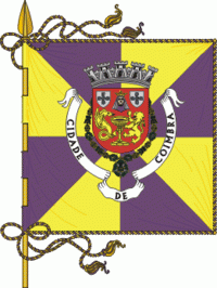
Coimbra (, also or ) is a city and a municipality in Portugal. The population of the municipality at the 2011 census was 143,397, in an area of 319.40 km2. The fourth-largest urban area in Portugal after Lisbon, Porto, and Braga, it is the largest city of the district of Coimbra and the Centro Region. About 460,000 people live in the Região de Coimbra, comprising 19 municipalities and extending into an area of 4336 km2.

Among the many archaeological structures dating back to the Roman era, when Coimbra was the settlement of Aeminium, are its well-preserved aqueduct and cryptoporticus. Similarly, buildings from the period when Coimbra was the capital of Portugal (from 1131 to 1255) still remain. During the late Middle Ages, with its decline as the political centre of the Kingdom of Portugal, Coimbra began to evolve into a major cultural centre. This was in large part helped by the establishment of the first Portuguese university in 1290 in Lisbon and its relocation to Coimbra in 1308, making it the oldest academic institution in the Portuguese-speaking world. Apart from attracting many European and international students, the university is visited by many tourists for its monuments and history. Its historical buildings were classified as a World Heritage site by UNESCO in 2013: "Coimbra offers an outstanding example of an integrated university city with a specific urban typology as well as its own ceremonial and cultural traditions that have been kept alive through the ages."

 
Map - Coimbra
Map
Google - Map - Coimbra
Google
Google Earth - Map - Coimbra
Google Earth
Openstreetmap - Map - Coimbra
Openstreetmap
Map - Coimbra - Esri.WorldImagery
Esri.WorldImagery
Map - Coimbra - Esri.WorldStreetMap
Esri.WorldStreetMap
Map - Coimbra - OpenStreetMap.Mapnik
OpenStreetMap.Mapnik
Map - Coimbra - OpenStreetMap.HOT
OpenStreetMap.HOT
Map - Coimbra - OpenTopoMap
OpenTopoMap
Map - Coimbra - CartoDB.Positron
CartoDB.Positron
Map - Coimbra - CartoDB.Voyager
CartoDB.Voyager
Map - Coimbra - OpenMapSurfer.Roads
OpenMapSurfer.Roads
Map - Coimbra - Esri.WorldTopoMap
Esri.WorldTopoMap
Map - Coimbra - Stamen.TonerLite
Stamen.TonerLite
Country - Portugal
Flag of Portugal
Portugal, officially the Portuguese Republic (República Portuguesa ), is a country located on the Iberian Peninsula, in southwestern Europe, and whose territory also includes the Atlantic archipelagos of the Azores and Madeira. It features the westernmost point in continental Europe, and its Iberian portion is bordered to the west and south by the Atlantic Ocean and to the north and east by Spain, the sole country to have a land border with Portugal. Its two archipelagos form two autonomous regions with their own regional governments. Lisbon is the capital and largest city by population.

One of the oldest countries in Europe, its territory has been continuously settled, invaded and fought over since prehistoric times. The territory was first inhabited by pre-Roman and Celtic peoples who had contact with Phoenicians, ancient Greeks and Carthaginians. It was later ruled by the Romans, followed by the invasions of Germanic peoples and the Islamic invasion by the Moors, whose rule was eventually expelled during the Reconquista. Founded first as a county of the Kingdom of León in 868, gained its independence as the Kingdom of Portugal with the Treaty of Zamora in 1143.
Currency / Language  
ISO Currency Symbol Significant figures
EUR Euro € 2
ISO Language
PT Portuguese language
Neighbourhood - Country  
  •  Spain 
Administrative Subdivision
Country, State, Region,...